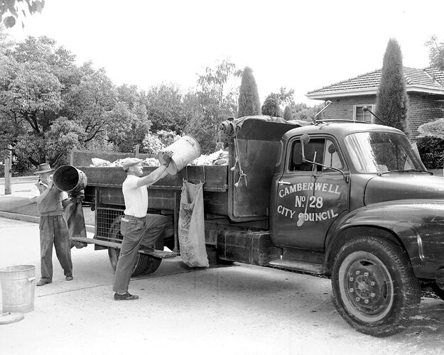
The Shire of Camberwell and Boroondara was located 9km east of Melbourne, existing from 1902 to 1994. It was originally part of the hunting grounds of a Wurundjeri clan of Woiwurrung people.
The first Europeans to settle in the area were John Gardiner and his family, who arrived in 1837.
Robert Hoddle surveyed the area in the same year, and named it the 'Parish of Boroondara' from the Woiwurrung language, meaning 'where the ground is thickly shaded'. The first land sales took place in January 1845.
Until the 1850s settlers used the land for grazing, being 'light sandy country, timbered with gum and oak'. Roads were rudimentary. In 1853 an inn was constructed where three roads intersected. Its owner, George Eastaway, recalled that several roads converged at Camberwell Green, London, and decided to call his hotel Camberwell Inn. The name was later adopted for the district as a whole.
The first local government body was the Boroondara District Road Board, formed in 1854. It incorporated the areas which were to become Hawthorn, Kew and Camberwell. Hawthorn and Kew became separate municipalities in 1860.
Farms in the Camberwell area were cleared and cropped by immigrants and former gold diggers, producing hay, fruit and vegetables. In the 1860s two small settlements had developed, one around the Anglican church and another to the east at Hartwell. The district's first school (1858) and post office (1862) were at Hartwell. The school closed when one was opened in 1867 a few hundred metres from the junction.
By the 1870s Camberwell was still an area of small farms, with a few larger homes at its elevated northern end. Industrial development remained minimal.
The remaining area of the Boroondara District Road Board became Boroondara Shire on 17 November 1871 in 1871.
In 1882 the railway was extended from Hawthorn to Camberwell. In 1891 a north-south Outer Circle railway line from Oakleigh to Fairfield was opened, crossing the earlier one at East Camberwell. It was unsuccessful and soon closed. The railway lines saw the development of the Burke Road shopping centre, between the railway station and the junction. The railway also attracted land subdivision. Blocks of land were relatively large, cheap and within convenient commuting distance of Melbourne. Camberwell's urban development soon spread. Council turned its face against noxious industry, building on small allotments and disfiguring advertising billboards.
As well as being suburban Camberwell was pious. All major denominations had large followings. A strong local temperance movement succeeded in carrying a poll of residents for the closure of hotels and wine saloons in 1920. The Camberwell lnn was replaced with a milk bar.
Boroondara Shire became Camberwell and Boroondara Shire in 1902, the year it issued a medal to commemorate the coronation of Edward VII (NU 20241).
It became the City of Camberwell on 20 April 1914.
By the 1980s and 1990s the median housing price in the Camberwell municipality was above the metropolitan average. In 1990 there were 30 government and 36 non-government school campuses in Camberwell, and the proportion of non-government school students was 19% higher than the metropolitan average.
In 1992 Council entered in to a contract for redevelopment of land at the rear of the Burke Road shops, but strong resident reaction led to Council repudiating the contract. On 22 June 1993 Council was suspended and replaced with a Government appointee. The City of Camberwell Council was amalgamated with Hawthorn, and Kew cities.
On 22 June 1994 the Cities of Camberwell, Hawthorn and Kew united to form the Boroondara City Council. It occupies an area approximating the original Road Board District.
References:
Boroondara City Council website http://www.boroondara.vic.gov.au/yourcouncil/yourcouncil.asp?PageId=377
Municipal Association of Victoria website http://www.mav.asn.au/
Australian Places website, Monash University, http://arts.monash.edu/ncas/multimedia/gazetteer/list/camberwell.html
Blake, L. (1977). Place Names of Victoria.
More Information
-
Keywords
-
Localities
-
Authors
-
Article types
