Geelong West is a residential suburb immediately adjoining Geelong on Corio Bay, which is on the western side of Port Phillip Bay. The Municipality of Geelong West, which existed between 29 May 1875 and 18 May 1993, included Herne Hill and Manifold Heights.
In the 1830s high speculative prices were being paid for land in central Geelong, which probably prompted the government to sell off 10 hectare blocks in the Geelong West area in 1839. Smaller blocks of about 0.6 hectares were sold two years later, and soon a contemporary almanac was referring to 'Ashby Village'. Between 1843 and 1846 the land between Geelong and Geelong West was was sold as suburban allotments. An area south of Ashby became known as Little Scotland, although in the 1857 census it did not have a high population of Scottish or Presbyterian residents. To the north of Ashby there also developed Kildare Village, although again census data does not reveal a particularly large Irish population.
Nevertheless, several church schools soon opened: Anglican at Kildare (1851); Presbyterian at Ashby (1852); Catholic at Ashby (1853) and Kildare (1855); and Methodist at Ashby (1855). None lasted much beyond 1874 when the Ashby Public School - later Geelong West primary - was opened.
Other infrasctucture began to develop in the 1850s. Shopping in Geelong West began in Pakington Street, later the main shopping strip in the area. In 1857 the Geelong railway station was opened in Ashby, and in 1858 the Geelong Gas Works was founded in Kildare.
During the mid 1850s there was local agitation for municipal separation from the Geelong town council. Twenty years of effort were rewarded on 29 May 1875, when the Geelong West borough was proclaimed. Its western and eastern boundaries were McCurdy Road and La Trobe Terrace respectively, and the northern and southern boundaries more or less Church Street and Aberdeen Street.
Geelong West continued to develop as an industrial area, with brick single- and two-storied industrial buildings. The largest factory was Donaghy's Rope Works (1873) in Pakington Street. The Newberry foundry (1886) in Lupton Street was a source of both local employment and cast-iron building materials used for the many timber houses to be found in Geelong West. Single-storey timber houses appeared, varying from cottages to substantial homes.
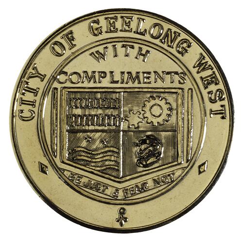
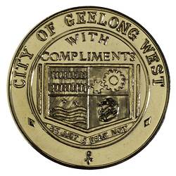
In 1897 the Borough of Geelong West issued a medal to commemorate Queen Victoria's Diamond Jubilee [NU 20427]. By that date it had 5,682 people and covered 859 acres.
In 1912 Geelong West finally welcomed its first tram; other tram lines ran along Church Street and Latrobe Terrace, confined to the eastern side of the municipality. By 1926 nearly two-thirds of the municipality still lacked adequate transport, and Benders Busways started several routes to provide local services.
Geelong West became a Town in 1922 and a City on 17 April 1929.
After World War II timber houses declined in popularity as families preferred newer, brick residences. Many cottages were demolished, and it was not until the 1980s that timber houses were again seen as desirable. In 1954 a technical school was founded (later Western Heights Secondary College) in Herne Hill.
Pakington Street remains the civic and commercial centre with Baptist, Uniting and Presbyterian churches, the former Geelong West town hall (rebuilt 1923), library, nearby Ashby and St. Patricks Catholic primary schools and a long shopping strip. It includes one of Victoria's oldest buildings, the former Harp Inn. Geelong West has four reserves (three with ovals), and there are more reserves in the former municipality's suburbs of Herne Hill and Manifold Heights.
On 18 May 1993, Geelong West city became part of Greater Geelong city.
References:
Australian Places website, Monash University, http://arts.monash.edu/ncas/multimedia/gazetteer/, accessed 24/11/2003.
Municipal Association of Vcitoria website http://www.mav.asn.au/CA256C2B000B597A/HomePage?ReadForm&1=Home~&2=~&3=~, accessed 24/11/2003.
Victorian Municipal Directories 1897.
More Information
-
Keywords
-
Localities
-
Authors
-
Article types