Kew is a residential suburb 6 km east of Melbourne. It is bordered to the west and north by the Yarra River, to the south by Hawthorn and to the east by Balwyn.
The prominent early settler of the Kew area was John Hodgson, who in 1840 took a squatting licence over what was later named Studley Park, after his birthplace at Studley, Yorkshire. Eleven years later the Crown began to sell off land in lots of between 15 and 80 hectares. One of the purchasers, Nicholas Fenwick, subdivided his 495-hectare estate into quarter-hectare blocks with streets laid out, named after English statesmen such as Walpole and Gladstone. The subdivision, north-east of the Kew junction, bordered by Princess and High Streets, was named Kew probably because its proximity to Richmond recalled the relationship between suburbs of the same names in London.
By 1854 two hotels had opened in High Street by 1854, one at the junction and the other, the Harp of Erin, at the corner of High Street and Harp Road. High Street soon developed two strip shopping centres, the main one east of Kew junction and the other near the Harp Hotel.
Congregational, Baptist, Primitive Methodist and Anglican churches were soon opened, and church-based schools began to develop, followed by government schools.
In 1856 the Boroondara Road Board District, comprising Kew, Hawthorn and Camberwell, was proclaimed. Two years later direct access to Kew was gained when the Johnston Street bridge was built. Kew seceded from the Board and was proclaimed a municipality on 22 December 1860. It became a borough on 1 October 1863.
Some way north of the village of Kew, next to the river, a site was reserved for a 'mental asylum' in 1856. The building was completed by 1871, becoming the Willsmere Hospital. The Kew Cottages for children were added in 1887. The institution contrasted to the well-to-do homes in neighbouring streets.
The first public transport service in Kew was a horse tram from the Hawthorn railway station that started in 1876. Railway was connected to the area a decade later. In 1878 Kew gained the first of its many private schools, Ruyton Girls' School (Anglican) and Xavier College (Jesuit Fathers). Other private schools followed, some housed in large mansions. By 1990 this meant that non-government school pupil populations were fifteen times those of the government school populations.
Kew is generously provided with parks, owing to far-sighted planning. In 1877 the colonial government reserved the Yarra Bend Park and Studley Park. Yarra Bend was the site of the first asylum (hence the pejorative expression 'gone around the bend'). Both parks retain much of their original bush land, although part of the park in Kew has had an excision for a golf course. Other parks include Alexandra Gardens, located in the original village.
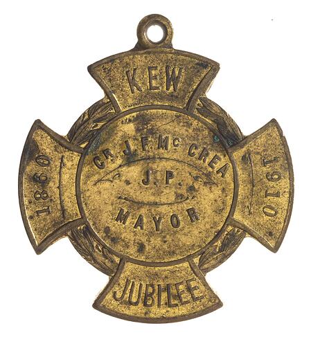
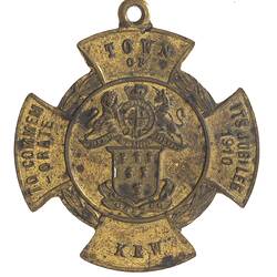
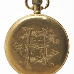
Kew held its Jubilee in 1910, and issued a medal to commemorate the event (NU 33021). Between 1910 and the outbreak of the second world war Kew's population approximately tripled. Kew was proclaimed a town on 8 December, 1910, and a city on 10 March, 1921. Post-war housing growth occurred in outlying areas near Yarra Bend Park and around Stradbroke Park to the north-east.
On 22 June, 1994 Kew city was united with Camberwell and Hawthorn cities to form Boroondara city.
References:
Australian Places website, Monash University http://arts.monash.edu/ncas/multimedia/gazetteer/list/kew.html, accessed 27/10/2003.
More Information
-
Keywords
-
Localities
-
Authors
-
Article types


