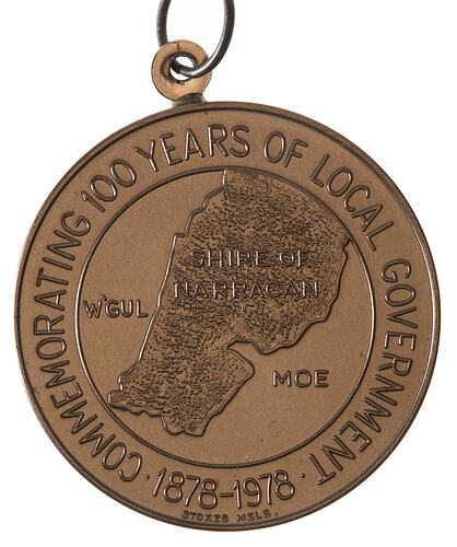
Narracan is located in Gippsland, east of Melbourne, 13km south-west of Moe. It was named after the Aboriginal word 'narraguan', meaning crow. The Narracan Shire included the gold-mining town of Walhalla and the coal-mining centre of Yallourn.
The first Gippslanders, the ancestors of the Ganai, inhabited the region at least 22,000 years ago. For many decades the Ganai heard rumours of the white invaders and began to suffer introduced diseases before they saw them. Early contacts with the invaders were bloodier than most. This was partly due to the region's isolation from civilisation and authority, a predominantly young, male, white population including hardened ex-convicts and escapees, world-weary soldiers, and fortune seekers who had little compassion and little respect for the law. Between 1840 and 1860 the white population of Gippsland grew from a few to almost 2,000; the Ganai population fell from over 2,000 to only a handful.
Gold rushes were significant in the early development of the Shire. As well as Walhalla itself, gold rushes occurred in the surrounding areas of Tanjil, Jordan River, Donnelly's Creek and Aberfeldy. At Coopers Creek copper mining also developed.
The early 1860s in Gippsland were marked by an increasing clamour for local government. By May 1878 a public meeting was held and a committee formed to plan boundaries and forward a petition to the government. On 20 September 1878 the Narracan Shire was gazetted, stretching from the Moe River a little beyond Yarragon to the existing Rosedale Shire boundary. The plan was not well received, with many locals concerned about a rate burden being imposed upon their already heavy financial commitments. In 1880 a petition asked the Minister to sever their district from the Alberton Shire to the Narracan Shire. The request was granted, resulting in the Narracan Shire stretching south almost to Korumburra.
In the twentieth century timber milling spread in the Erica area. In 1909 the seat of local government in the Narracan Shire moved to Trafalgar.
By the 1920s Walhalla was becoming a tourist destination. In the 1950s the Mount Baw Baw ski fields began to develop.
On 2 December 1994 the Shire of Narracan ceased to exist when Baw Baw Shire Council was created by Order of the Governor in Council, combining the Shires of Narracan and Buln Buln, the Rural City of Warragul, and part of the Shire of Upper Yarra. Some of the Shire of Narracan became part of the Latrobe City Council on the same day.
Today the Narracan District is a rural electorate. Industries in the Narracan area today include agriculture, timber production, mining and manufacturing.
References:
City of Latrobe website http://www.latrobe.vic.gov.au/content.cfm?topicid=80
Adams, J. Mountain Gold: A History of the Baw Baw and Walhalla Country of the Narracan Shire, Victori
Municipal Association of Victoria website http://www.mav.asn.au/CA256C2B000B597A/Frame?ReadForm&1=25Council+Contacts~&2=~&3=~&URL=http://www.mav.asn.au/guide.nsf/Web/index?OpenDocument~
More Information
-
Keywords
-
Localities
-
Authors
-
Article types