Oxley is an agricultural township in north-east Victoria. It is situated on the King River, 12 km. south-east of Wangaratta and west of Beechworth.
In 1824 the explorers Hume and Hovell named the Oxley Plains after the New South Wales Surveyor-General, John Oxley. Oxley's name derives from this origin.
In 1852 prospectors began to travel to the Ovens Valley gold diggings. They stopped at Greta, south-west of Oxley, then crossed the King and Ovens Rivers. An east-west road was formed across the Oxley Plains between the crossing places on the rivers, and the Oxley township grew at the King River crossing place. About four kilometres eastwards Milawa township also formed, and the two competed for trade and growth for decades to come. The first school, although named Oxley, was opened in Milawa in 1864. Oxley first school did not open for another ten years.
The Oxley Road District was proclaimed in 1862, and it became a shire in 1865. Meetings were held in Milawa until a shire hall was built in Oxley in 1875.
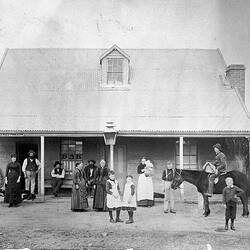
By 1903 Oxley had a money-order office and a railway station, hotel, school, a Baptist church, Protestant hall and a shire hall. 58 people lived there, with a total of 4,118 in the shire. The surrounding district was agricultural, dominated by wheat crops that benefited from rich alluvial river flats. A daily coach ran to Milawa. Many inhabitants shopped in Wangaratta or Myrtleford, and Moyhu, in the middle of the shire, is considerably larger than Oxley.
The township of Oxley remained the administrative centre of Oxley Shire until 1936, and council meetings continued at the shire hall in Oxley until 1966. Milawa retained the court of petty sessions. Wangaratta became the location of the council offices in the 1930s.
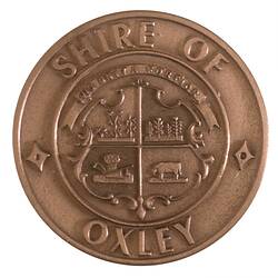
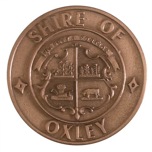
In 1985 the Shire of Oxley issued a medal to commemorate the Sesquicentenary of Victoria.
On 18 November 1994 the Shires of Oxley and Wangaratta, the City of Wangaratta, and part of Shires of Beechworth, Benalla and Yarrawonga combined by order of the Governor in Council to become Wangaratta Rural City Council.
Oxley township today has a store, primary school, hall and a recreation reserve. The shire hall and a former steam-driven flour mill are on the Register of the National Estate.
References:
Australian Places website, Monash University, http://arts.monash.edu/ncas/multimedia/gazetteer/list/oxley.html
Municipal Association of Victoria website http://www.mav.asn.au/CA256C2B000B597A/Frame?ReadForm&1=25-Council+Contacts~&2=~&3=~&URL=http://www.mav.asn.au/guide.nsf/Web/index?OpenDocument~
More Information
-
Keywords
-
Localities
-
Authors
-
Article types