Summary
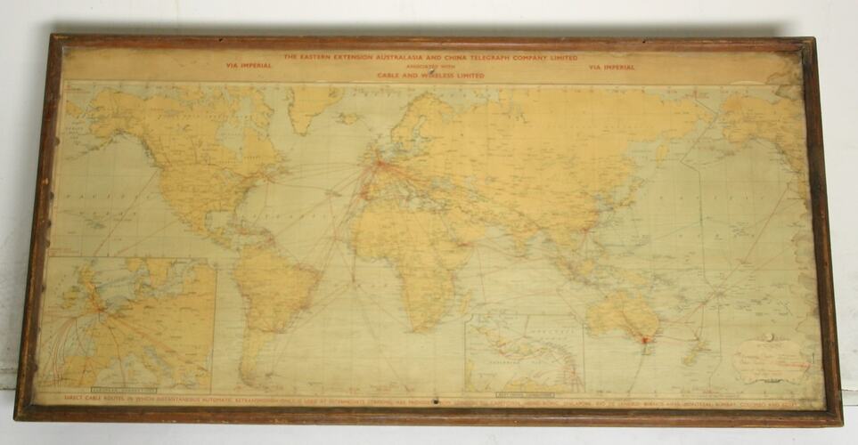
World map issued by the Eastern Extension Australasia and China Telegraph Co. Ltd., associated with Cable and Wireless Limited, illustrating direct cable routes across the globe.
The map is undated but it shows the trans Pacific cable from Western Canada to Eastern Australia. This cable was completed in 1902.
Physical Description
Map of the world printed on paper housed in a wood frame behind clear plastic, with board backing. Thin red lines, both straight and perforated, extend across the map from a point at London. Two smaller, more detailed maps of Europe and the West Indies are located along the lower edge. The title of the map is printed in red across the top and bottom.
More Information
-
Collection Names
-
Collecting Areas
-
Acquisition Information
Unknown Acquisition Method from Unknown Source - Likely Donation, Before 28 Feb 1991
-
Inscriptions
Title, above: "THE EASTERN EXTENSION AUSTRALASIA AND CHINA TELEGRAPH COMPANY LIMITED / ASSOCIATED WITH / CABLE AND WIRELESS LIMITED / VIA IMPERIAL" Title, below: "DIRECT CABLE ROUTES IN WHICH INSTANTANEOUS AUTOMATIC RETRANSMISSION ONLY IS USED AT INTERMEDIATE STATIONS, ARE PROVIDED FROM LONDON TO CAPETOWN, HONG KONG, SINGAPORE, RIO DE JANEIRO, BUENSO AIRES, MONTREAL, BOMBAY, COLOMBO AND EGYPT" Smaller maps: "EUROPEAN CONNECTIONS / WEST INDIAN CONNECTIONS"
-
Classification
-
Category
-
Discipline
-
Type of item
-
Framed
102 cm (Length), 52 cm (Width), 2 cm (Height)
-
References
[Link 1] accessed 19 June 2009
-
Keywords