Summary
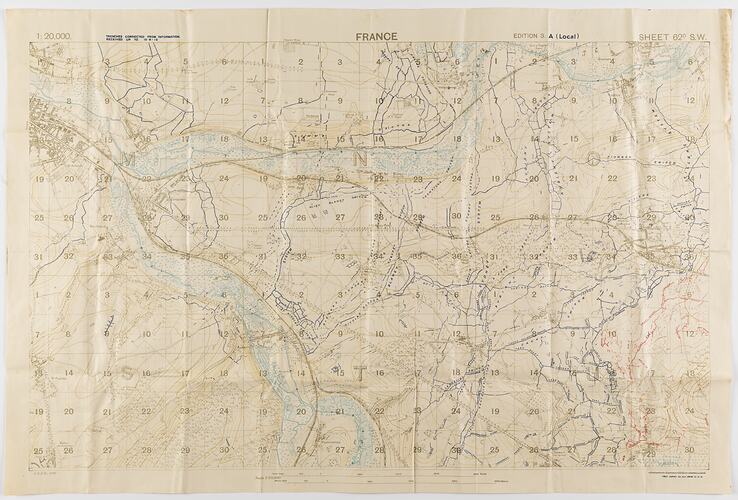
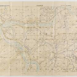
One of two copies of a military trench map, France, sheet 62 D. S. W., edition 3.A., (local) scale 1:20,000. Trenches corrected from information received up to 15 June 1918. Field Survey Co., R. E. (3808), dated 18 June 1918. The map depicts the Somme River area to the east and south-east of Amiens, including Villers-Bretonneux.
Used by Capt. M. Lewis during World War I. Captain Morris Lewis, 44th Battalion, Third Division, First AIF, was born in Wales in 1892 of Jewish heritage. He was a 23-year-old tailor living in Perth when he enlisted to serve in World War I. He applied for a commission in May 1916, and left Fremantle for England on 6 June 1916, where he received training. Lewis was sent to the front in France in November 1916. He was serving with the 44th Battalion in the vicinity of Villers-Bretonneux in June 1918, when this map was printed.
Lewis was wounded on 29 September 1918. He was awarded the Military Cross 'For conspicuous gallantry and devotion to duty when the enemy delivered a couterattack and penetrated part of the line. This officer led a party and drove him out, inflicting severe casualties. He set an excellent example to his men.' He survived the war and served again in World War II.
Physical Description
Military map on off-white cloth-backed paper. Printed in printed blue and brown on off-white. Degrees along axes. Scale and key at bottom. Blank back. Slightly discoloured along folds.
More Information
-
Collection Names
Military Memorabilia Collection, Returned and Services League (RSL) Collection
-
Collecting Areas
-
Acquisition Information
Donation from Victorian Branch, Returned & Services League of Australia Limited (RSL), 24 Feb 1986
-
Place & Date Depicted
-
Past Owner
Captain Morris '. Lewis - 44th Battalion, 3rd Division, 1st A.I.F.
-
Previous Owner
Captain Morris '. Lewis - 44th Battalion, 3rd Division, 1st A.I.F.
-
Inscriptions
Printed on front: '1:20,000. / TRENCHES CORRECTED FROM INFORMATION / RECEIVED UP TO 15.6.18 / FRANCE / EDITION 3.A (Local) SHEET 62D. S.W. / G.S,G.S. 2742 / Ordnance Survey, (O.B.) June, 1918 [crossed out] / FIELD SURVEY CO., R.E. (3808) 18-6-18'.
-
Classification
-
Category
-
Discipline
-
Type of item
-
Primary support
842 mm (Width), 564 mm (Height)
-
Keywords