Summary
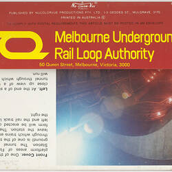
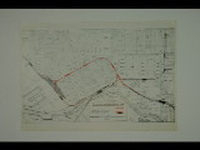
Plan of the proposed Melbourne Underground Rail Loop printed in red ink over a map of existing rail lines and roads in inner Melbourne. Scale 1000 feet to ¾-inch (approx 1:17,950). The plan was probably published by the Melbourne Underground Rail Loop Authority in about 1978, after construction commenced but before the three new underground stations had been named.
The creation of Melbourne Underground Rail Loop was an extraordinary undertaking, which changed the look and daily operation of Melbourne's central business district. Construction commenced in 1971, and the project was completed with the opening of Flagstaff Station in 1985. Before the Loop, around 90 per cent of all rail passengers travelling to the city travelled through Flinders Street Station. This caused serious congestion for both passengers and trains. The Loop provided customers with a choice of five stations around the central business district (three of which we unnamed at the time this map was published) and avoided operational problems associated with trains having to reverse direction at Flinders Street.
As early as 1929, the Metropolitan Town Planning Commission recommended the construction of railway tracks and stations under the eastern and northern sides of the central business district, with connections to the existing railway system in the vicinity of North Melbourne and Richmond. The 1969 Melbourne Metropolitan Transport Plan also supported the need for an underground loop, and proposed a design similar to that finally agreed upon.
The first station, Museum (now Melbourne Central), was officially opened on January 24th, 1981.
Physical Description
Single-sided. Printed in black and red ink on plain white stock.
More Information
-
Collecting Areas
-
Acquisition Information
Donation from J. Flack, 29 Jan 2010
-
Publisher
Melbourne Underground Rail Loop Authority, Melbourne, Victoria, Australia, circa 1978
Probable publisher. -
Inscriptions
Text, printed: MELBOURNE UNDERGROUND RAIL LOOP.
-
Classification
Rail transport, Railway infrastructure - underground loop, Publicity materials
-
Category
-
Discipline
-
Type of item
-
Overall Dimensions
298 mm (Width), 208 mm (Height)
-
Keywords
Civil Engineering, Construction, Maps, Plans, Railway Construction, Railway Lines, Underground Railways