
Summary
Official visitors' map for Marysville and Lake Mountain published by Tourism Victoria, circa 2008, This leaflet has extensive motor map of the area ranging from Taggerty to the Yarra Ranges. Detailed smaller specific maps contain thorough information and include touring routes. The interior includes a large colour fold-out map and colour photographs of local places of interest and businesses. The pamphlet includes advertising for local businesses such as accommodation, attractions and activities. Calendar events and natural attractions for Marysville, Lake Mountain and surrounding areas are also listed.
This was collected in February 2009 following Black Saturday for the Victorian Bushfires Collection.
Physical Description
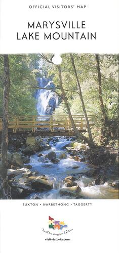
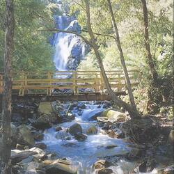
49 page soft cover pamphlet includes a cover featuring a picture of a wooden bridge with a waterfall in the background.
Significance
This pamphlet presents a poignant snapshot of the tourist services and infrastructure which was present before the Black Saturday bushfires. Many of the landscapes and establishments listed in the pamphlet no longer exist or have been greatly impacted by the bushfires, and this demonstrates the strain the bushfires have had, and continue to have on the environment, economy and community of Marysville and Lake Mountain..
More Information
-
Collection Names
-
Collecting Areas
-
Acquisition Information
Donation from Ms Margaret Baker - Yarra Valley Regional Tourism Association, 2010
-
Publisher
-
Advertiser
-
Inscriptions
Official Visitors' Map/MARYSVILLE/LAKE MOUNTAIN/BUXTON.NARBETHONG.TAGGERTY/ You'll love every piece of Victoria/VISITVICTORIA.COM/
-
Classification
-
Category
-
Discipline
-
Type of item
-
Overall Dimensions - Folded
101 mm (Width), 211 mm (Height)
-
Keywords