Summary
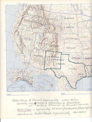
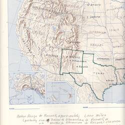
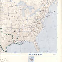
A printed map depicting the United States of America published by Rand McNally & Company. This map was likely annotated by Dr Dorothy Howard in preparation of Dr June Factor's visit to New Mexico in circa 1983. In a letter to Dr Factor in December 1982, Dr Howard writes: 'As a prelude to your visit to Roswell and to begin conversation, I am including - first - a nutshell history of New Mexico and Roswell accompanied by a map of the U.S. which you and Naomi may find useful in plotting your journeys hither and yon' (see HT 42340). Dr Howard has recorded the name of each state, highlighting in green the states of New Mexico and Texas. Below the map, she has written possible routes and destinations with distances.
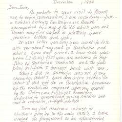
One of a collection of letters written to and from children's Folklorist Dr Dorothy Howard between 1954 and 1995. Dr Howard came to Australia in 1954-55 as an American Fulbright scholar to study Australian children's folklore. She travelled across Australia for 10 months collecting children's playground rhymes, games, play artefacts, etc. The original fieldwork she collected during this period is held in the Australian Children's Folklore Collection (ACFC) at Museum Victoria and includes index cards, letters and photographs.
Physical Description
Blue and brown map printed on paper. Features printed text in blue ink and handwritten annotations in black ink overall. Sections of the map have been highlighted with green ink.
More Information
-
Collection Names
Australian Children's Folklore Collection, Dorothy Howard Collection
-
Collecting Areas
-
Acquisition Information
Cultural Gifts Donation from Dr June Factor, 18 May 1999
-
Acknowledgement
Donated through the Australian Government's Cultural Gifts Program.
-
Collector
-
Printer & Publisher
-
Past Owner & User
-
Classification
-
Category
-
Discipline
-
Type of item
-
Overall Dimensions
380 mm (Width), 280 mm (Height)
Orientation: landscape
-
Keywords