Summary
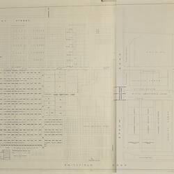
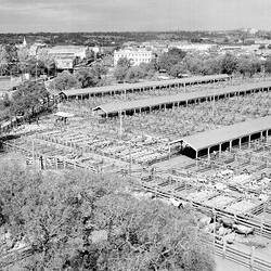
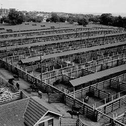
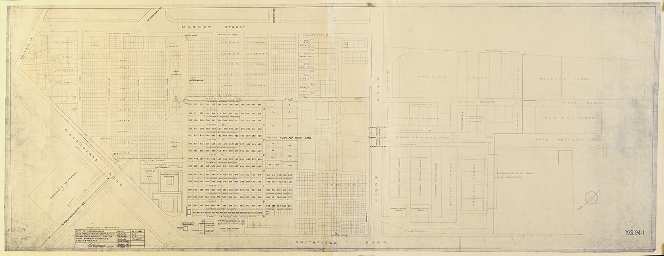
Plan of Newmarket Saleyards, dated 17 November 1961.
Identifies in detail gangways, races, lanes, stock route, pens, bridges, holding yards, milch cow market, old cow bail, timber stores, plumbers & engineers' shop, carpenter, amenities building, drovers' hut, sub-station, toilets, administrative offices, plantation, tar shed, loading race and counter's box. Plan also identifies covered areas. Marked streets are Newmarket Street, Bellair Street, McCracken Street, Gordon Street, Racecourse Road, Export Lane, Main Abbatoirs Lane, Back Abbatoirs Lane, Smithfield Road, Market Street, Epsom Road. North east border - Bellair Street; south east border - Market Street; north west border - Smithfield Road; south west border - just beyond the boundary of cattleyards and abattoirs.
Physical Description
Copy of blueprint. Has been roughly cut with scissors along all edges.
More Information
-
Collection Names
-
Collecting Areas
-
Acquisition Information
Donation from Major Projects Unit, State Government of Victoria, 31 Jan 1990
-
Place & Date Depicted
Newmarket Saleyards, Newmarket, Greater Melbourne, Victoria, Australia, 17 Nov 1961
-
Inscriptions
Text reads: "City of Melbourne/City Architects Department/Plan of Existing Cattle/ and Sheep Market/Newmarket/17.11.1961". Signed by City Architect, 17/11/61: "G. L. Czanne" (?). Lower right hand corner: "Y.G. 94.1"
-
Classification
-
Category
-
Discipline
-
Type of item
-
Overall Dimensions
195.5 cm (Length), 77.9 cm (Height)
-
Keywords
Livestock, Livestock Sale Yards, Plan Drawings, Rural Industry, Working Life, Making History - Newmarket Saleyards