Summary
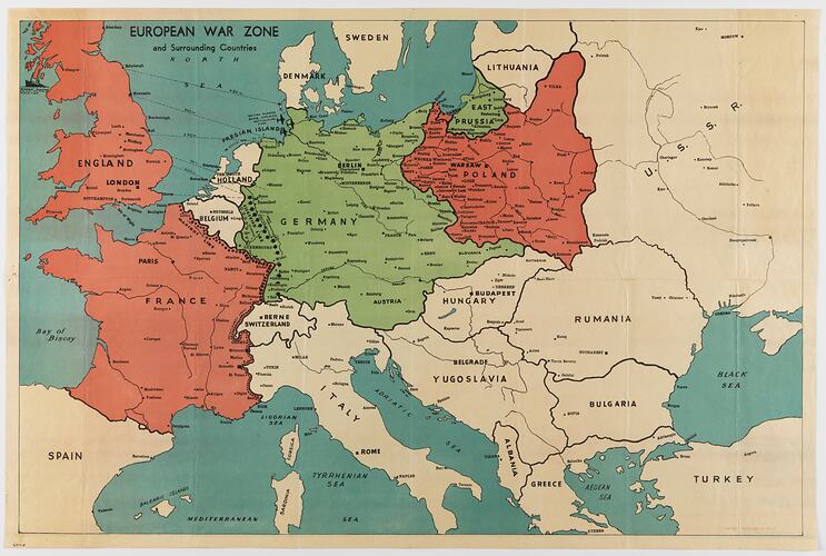
Map of the European war zone during World War II. In the upper right corner it depicts the sinking of the Athenia, which was sunk on 1 September 1939.
Part of a collection of material relating to the World War I service of brothers John and Albert Victor Peile. The donor's connection to World War II is unknown.
Description of Content
Coloured map of Europe.
Physical Description
Printed colour map with Poland, England and France shaded pink and Germany green. Surrounding countries are unshaded and surrounding bodies of water are blue. Lines of fortification are marked by black dotted lines. Details include World War II-era planes and a partially-sunk ship, The Athena.
More Information
-
Collection Names
-
Collecting Areas
-
Acquisition Information
Donation from Victorian Branch, Returned & Services League of Australia Limited (RSL), Mrs Margaret J. Hitchens, 1986
-
Place & Date Depicted
-
Inscriptions
OFFSET PRINTING CO'. Extensive text throughout.
-
Classification
-
Category
-
Discipline
-
Type of item
-
Primary support
759 mm (Width), 506 mm (Height)
-
References
For Albert Peile's war record see the National Archives of Australia website at: [Link 1] For John Peile's war record see the National Archive of Australia website at: [Link 2]
-
Keywords