Summary
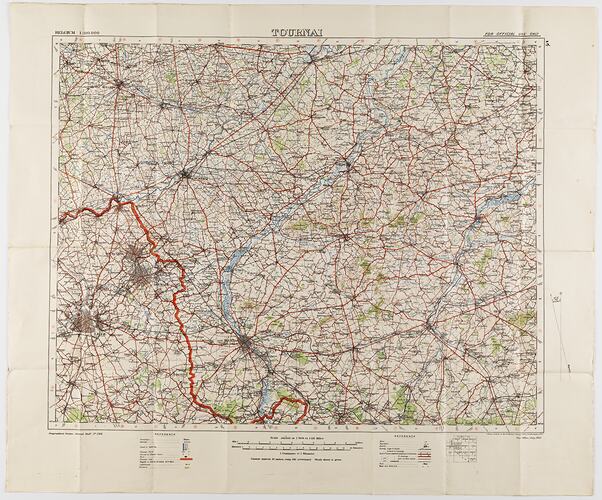
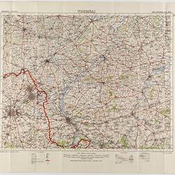
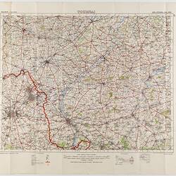
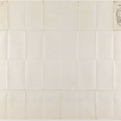
Two large folded maps, identical content, titled 'Tournai 5', Belgium, scale 1/100,000. They were printed for the Geographical Staff, General Staff, number 2364, and were 'Photo-etched at the Ordnance Survey Office, Southampton, 1912' . The map is labelled 'War Office, July, 1912'.
The maps were used by Captain Morris Lewis, 44th Battalion, Third Division, First AIF, during World War I. Lewis was born in Wales in 1892, of Jewish heritage. He had already undertaken six years' military service when he enlisted to serve in World War I. Lewis was then a 23-year-old tailor living in Perth. He applied for a commission in May 1916, and left Fremantle for England on 6 June 1916. He received training in England before going 'overseas' to the front in France in November 1916. He later returned to England, undertook more training, and then went back to France, where he was wounded on 29 September 1918. Lewis was awarded the Military Cross 'For conspicuous gallantry and devotion to duty when the enemy delivered a counterattack and penetrated part of the line. This officer led a party and drove him out, inflicting severe casualties. He set an excellent example to his men.'
Physical Description
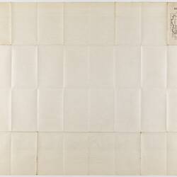
Two maps, each printed on off-white paper backed with cloth. Printing is red, green, blue and brown/orange. Scale and key at bottom. Back blank except for upper corner, printed in black, showing map in the context of the wider Belgium landscape. Deep creases from folding.
More Information
-
Collection Names
Military Memorabilia Collection, Returned and Services League (RSL) Collection
-
Collecting Areas
-
Acquisition Information
Donation from Victorian Branch, Returned & Services League of Australia Limited (RSL), 24 Feb 1986
-
Place & Date Depicted
-
Organisation Named
44th Battalion, 3rd Division, 1st Australian Imperial Force (AIF), 1912
-
Previous Owner
Captain Morris '. Lewis - 44th Battalion, 3rd Division, 1st A.I.F.
-
Printer
-
Format
Printed, paper base, Map, Colour
-
Language
English
-
Inscriptions
Printed on upper front: 'BELGIUM 1:100,000 / TOURNAI / FOR OFFICIAL USE ONLY '. Lower front: 'Geographical Section, General Staff, No. 2364 / Photo etched at the Ordnance Survey Office, Southampton, 1912 / War Office, July, 1912.' On back (serving as cover when folded): 'TOURNAI 5 / BELGIUM / Scale 1/100,000'.
-
Classification
-
Category
-
Discipline
-
Type of item
-
Keywords
Maps, Militaria: Australian, Military Memorabilia, World War I, 1914-1918