Summary
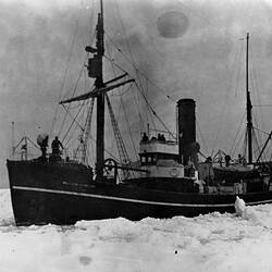
Photograph taken during an expedition to Antarctica and sub-antarctic islands, circa 1929. Probably taken by George Rayner.
Deception Island is part of the South Shetland Islands situated off the northern tip of the Antarctic Peninsula, at a latitude of 63 degrees South. Formed by volcanic activity, its visible land mass takes the form of a horseshoe surrounding a large centre bay known as Port Foster, which was created when seawater flooded the caldera of an ancient volcanic crater. Over half the land mass is covered by glaciers, while on the eastern side of the island Mt Pond rises to an elevation of 542 metres (1, 778 ft). Although Port Foster is one of the most sheltered harbours in Antarctica, its only entrance is a narrow 230 metre wide channel called Neptunes Bellows which opens to the south-east and is protected by sub-surface rocks.
Whalers Bay is a natural cove with a wide black sandy beach which lies just inside Neptunes Bellows. It was first used by sealers in the 19th century, before a Norwegian-Chilean company established a Whaling Station there in 1906. By 1914 there were 13 whaling factory ships operating out of Whalers Bay, but a drop in whale oil prices during the Great Depression, saw it close in 1931. The British operated a scientific base at Whalers Bay from 1944 till the late 1960s when it was abandoned due to volcanic activity in the vicinity.
Description of Content
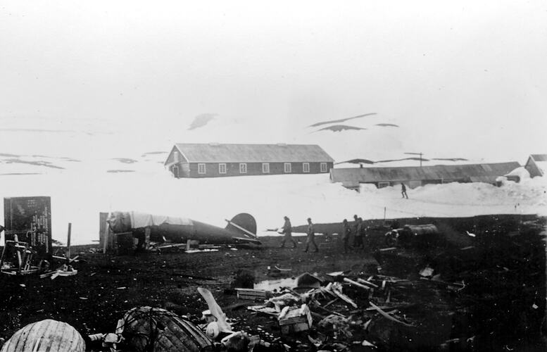
Debris on beach, Whalers Bay, Deception Island, November 1929. In the foreground are broken wooden packing crates and two small upturned boats. In the middle ground is an aircraft fuselage (without wings), possibly in the process of being assembled, covered by a tarpaulin. In the background on rising ground are two long single-gabled buildings that appear to be dormotories for a scientific station or whaling base, surrounded by deep snow drifts.
More Information
-
Collection Names
-
Collecting Areas
-
Acquisition Information
Donation from Mrs E. Rayner, 28 Jun 1984
-
Place & Date Depicted
Mr George Rayner, Deception Island, South Shetland Islands, Antarctica, Nov 1929
Biologist with the SS Discovery on investigations in the waters of the Falkland Islands Dependencies. Research included hydrographic surveying and whale marking. -
Individuals Identified
Rayner, George
-
Format
Photograph, paper base, Silver gelatin print, Black & White
-
Inscriptions
Photograph inscribed on back: 'DECEPTION NOV. 1929' and 'SIR H. WILKINS'.
-
Classification
-
Category
-
Discipline
-
Type of item
-
Overall Dimensions
7.9 cm (Width), 5.2 cm (Height)
-
Keywords
Antarctic Exploration, Antarctic Research, Antarctica, Beaches, Expeditions, Islands