Summary
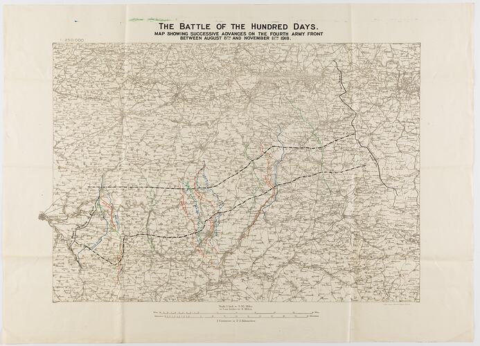
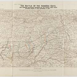
Field survey map of France, scale 1:250,000, titled 'The Battle of the Hundred Days', showing the successive advances on the Fourth Army front between 8 August and 11 November 1918, leading up to the Armistice. The map is dated 26 November 1918.
Coloured lines on the map indicate the 'Allied front line prior to attack' and the position of the front on August, 8, 10, 20 and 23; September 3, 17, 19 and 28; October 2, 5, 7, 17 and 23; and November 4, 8 and 11.
The map includes the area of the battle at Mont St Quentin in September-October 1918. Amongst the soldiers killed there was Frank Roberts, 21st Battalion, who died on 1 September.
Physical Description
Map printed in brown on off-white paper, with lines of advance shown in black, red, blue and green.
More Information
-
Collection Names
-
Collecting Areas
-
Acquisition Information
Donation from J. Lord, 1986
-
Date Inscribed
-
Place & Date Depicted
-
Format
Map, Black & White
-
Language
English
-
Inscriptions
Printed at top: 'THE BATTLE OF THE HUNDRED DAYS. / MAP SHOWING SUCCESSIVE ADVANCES ON THE FOURTH ARMY FRONT / BETWEEN AUGUST 8TH AND NOVEMBER 11TH 1918.' Printed below map, and lower right: 'FIELD SURVEY BN, R.E. (4590) 26.11.18'.
-
Classification
-
Category
-
Discipline
-
Type of item
-
Primary support
792 mm (Width), 572 mm (Height)
-
Keywords
Battles, Maps, Military Memorabilia, World War I, 1914-1918, Cartography, Armistice Day
