Summary
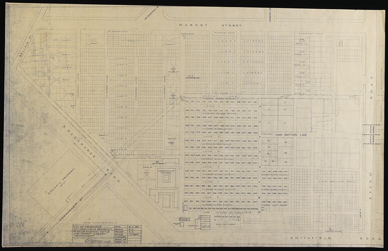
Plan of Newmarket Saleyards dated 16 November 1961. Amended 13 January 1975.
Physical boundaries of the map are: North East border - Bellair Street; South East border - Market Street; North West border - Smithfield Rd; South West border - Epsom Road.
Physical Description
Paper plan with black text and drawings.
More Information
-
Collecting Areas
-
Acquisition Information
Donation from Major Projects Unit, State Government of Victoria, 31 Jan 1990
-
Place Used
Newmarket Saleyards, Newmarket, Greater Melbourne, Victoria, Australia, 16 Nov 1961
-
Inscriptions
Text: 'City of Melbourne/City Architects Department/Plan of Existing Cattle/ and Sheep Market/Newmarket/16.11.1961 / Drawn G.G./ Traced: G.G. / Scale: 1" = 40'0'''.
-
Classification
-
Category
-
Discipline
-
Type of item
-
Overall Dimensions
1075 mm (Width), 680 mm (Height)
-
Keywords
Livestock, Livestock Sale Yards, Plan Drawings, Rural Industry, Working Life