Summary
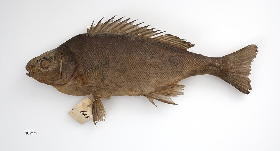
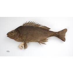
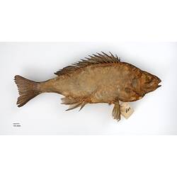
This specimen was collected during William Blandowski's expedition to the junction of the Murray and Darling Rivers (December 1856 - December 1857). One of the first fish collected on the expedition, it came from "Gunbower", Gunbower Station, the expedition's first base camp, 16-28 February. The original tag '625' is intact and the fish is listed in the expedition register by its local Koorie name 'Tarrum'.
Blandowski illustrated this species on 27 February 1857 (Museum fur Naturkunde, Berlin, B VIII/438), noting the local name 'Tarrum'. In his expedition report for the 'Transactions of the Philosophical Institute of Victoria' in 1858, he described it as Cernua bidyana (recognising it as the same species previously described by the explorer Thomas Mitchell in 1838). Blandowski also included the name 'Bagguck' given by the Yarree Yarree group of Aboriginal people he met at Mondellimin (Merbein, near Mildura), but omitted mentioning the name 'Tarrum' from Gunbower in his account. This part of his report was suppressed from publication during a fish naming scandal later that same year.
Later, Whitley described a new genus Bidyanus with Acerina (Ceruna) bidyana Mitchell 1838 as the type species, so the scientific name of the Silver Perch became Bidyanus bidyanus. The Yarree Yarree people at Mondellimin had used the names 'Bagguck', 'Buruitjall', 'Karpa' and 'Bipe purritjall' for four different adult and juvenile stages, and Blandowski, who relied heavily on Aboriginal knowledge in his research, had mistaken each life stage as a distinct species.
Once one of the most common and widespread fishes in the Murray-Darling Basin, Silver Perch have experienced significant declines in distribution and abundance throughout most of their range and no longer occur in the Central Murray Catchment. They are now listed nationally as Critically Endangered under the EPBC Act 1999, and as Threatened under the Victorian Flora and Fauna Guarantee Act 1988.
Classification
Specimen Details
-
Collection Names
-
Taxon Name
-
Author and date of publication
(Mitchell, 1838)
-
Preferred Common name
Silver Perch
-
Date Identified
05/06/2007
-
Identified By
Dianne J. Bray - Museums Victoria
-
Number Of Specimens
1
-
Sex
Unknown
-
Specimen Nature
Nature: Skin, Form: Dry
-
Expedition Name
Blandowski expedition to the junction of the Murray and Darling Rivers
-
Collected By
William Blandowski
-
Date Visited From
16/02/1857
-
Date Visited To
28/02/1857
-
Category
-
Scientific Group
-
Discipline
-
Collecting Areas
-
Type of Item
Taxonomy
-
Kingdom
-
Phylum
-
Subphylum
-
Superclass
-
Class
-
Order
-
Family
-
Genus
-
Species Name
bidyanus
Geospatial Information
-
Country
-
State
-
Precise Location
Gunbower area, between Mt Hope and Kow Swamp (as Kew Swamp)
-
Latitude
-35.9928
-
Longitude
144.281
-
Geodetic Datum
WGS84
-
Georeference Source
Google Earth
-
Georeference Protocol
Estimation
-
Georeference Date
2016-09-26T00:00:00
-
Georeference By
Dianne J. Bray - Museums Victoria