Summary
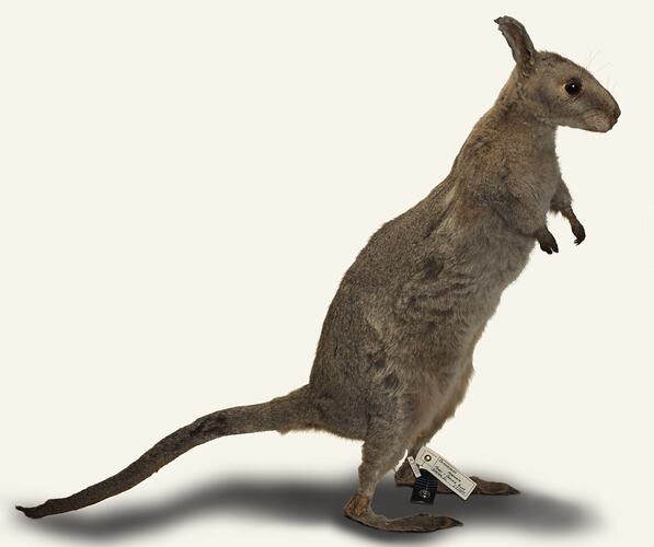
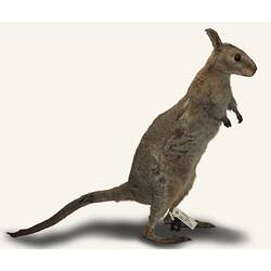
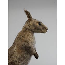
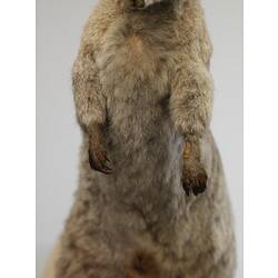
This specimen was collected during William Blandowski's expedition to the junction of the Murray and Darling Rivers (December 1856 - December 1857). Its original expedition tag and number are missing, and the precise locality is unknown. We know from expedition registers, reports and manuscripts however that this species was first collected at the base camp on Gunbower Station in late January 1857, and then found between Gunbower and Mondellimin (Merbein, near Mildura) from January-December 1857.
This is one of 34 mammal species recorded during the expedition, and the most common macropod seen, with approximately 65 specimens collected. In the 'Catalogue' and monthly consignment lists, they are initially recorded as 'Pademelons', the name used by colonist's, and then 'Merrin', the name given by the 'Murray natives', probably the Yarree Yarree people at Mondellimin. Krefft was able to observe this species in captivity, noting that 'it is easily tamed and a number of those kept at the camp would eat from the hand'. During this time he illustrated details of the head (Museum fur Naturkunde B VIII/234a) female reproductive openings (B VIII/234b), and front legs (B VIII/223). Back in Germany in 1861, Blandowski's artist Gustav Mutzel completed a painting of the whole animal (see B VIII/218) as Figure 2 in the plate of 'smaller kangaroos known as Bettongia' for the 'Mammals of Australia' series. Some of the specimens ended up on the expeditioners' menu as Kreftt observed 'its flesh is white and well tasted'.
The Bridled Nailtail Wallaby was once one of the most common macropods, with an historically wide distribution from the Murray River region of Victoria through central New South Wales to the base of Cape York in Queensland. This species no longer occurs in Victoria or New South Wales and is restricted to three small populations in central Queensland where it is listed as endangered.
Specimen Details
-
Collection Names
-
Taxon Name
-
Preferred Common name
Bridled Nail-tail Wallaby
-
Number Of Specimens
1
-
Sex
Female
-
Specimen Nature
Nature: Mount, Form: Dry
-
Expedition Name
-
Collected By
W Blandowski
-
Date Visited From
5/11/1857
-
Date Visited To
5/11/1857
-
Category
-
Scientific Group
-
Discipline
-
Collecting Areas
-
Type of Item
Taxonomy
-
Kingdom
-
Phylum
-
Subphylum
-
Class
-
Superorder
-
Order
-
Suborder
-
Family
-
Subfamily
-
Genus
-
Species Name
fraenata