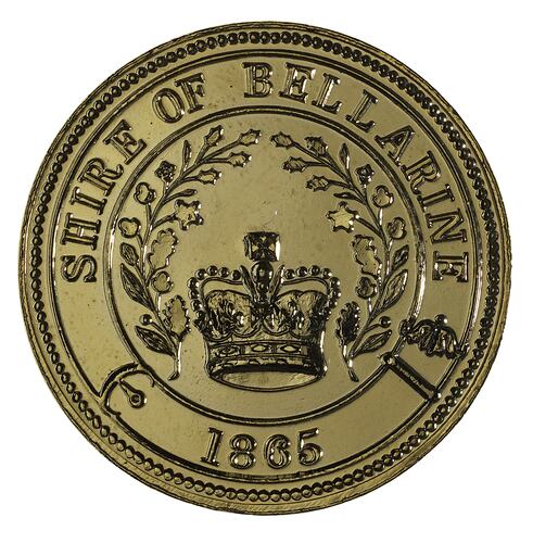
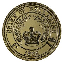
Bellarine is a rural locality to the west of Melbourne on the northern side of the Bellarine Peninsula, between Clifton Springs and Portarlington. It was named after the Aboriginal word 'balla' (elbow, or resting the elbow). The Municipality of Bellarine existed from 1865 to 1993.
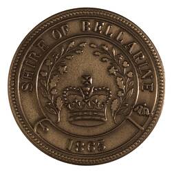
A Presbyterian church and a school were established in about 1854, the year the Bellarine road district was declared. Four years later a mechanics' institute was founded, and in 1865 a Wesleyan church and school opened. On 18 September of that year the Bellarine shire was proclaimed. It extended from Boundary Road, Geelong and along the east side of the Barwon River to Ocean Grove, occupying all of the Bellarine Peninsula except Queenscliff. Other coastal townships included Clifton Springs, Indented Head, Portarlington, Ocean Grove and St. Leonards. Inland were the Drysdale township and farmlands with good soil for agriculture. The shire's area was 332 square kilometres. The Shire headquarters were located in Drysdale.
By 1871 Bellarine municipality's census population was 3,802. The Peninsula's industries included creameries, wattle liquor factories and boiling-down works. Agricultural statistics for 1891-2 illustrate its farm crops for several decades to come: hay 4,764 acres, onions 1,984 acres, peas/beans 880 acres, potatoes and root crops 669 acres, wheat and barley 643 acres and market gardens and orchards 141 acres. Cereal crops were later phased out when the north Victorian wheatlands were developed.
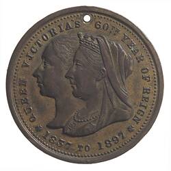
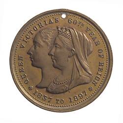
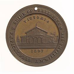
In 1897 Bellarine was one of many shires to issue a medal in commemoration of the diamond jubilee of Queen Victoria (NU 20436). The medal named Mr. F. J. Pacey as Shire President and A. McWilliams (sp?) as Secretary.
By 1949 Bellarine Shire was still predominantly an agricultural area, with some secondary industry at Drysdale in the form of a flax mill and cannery. Peas and asparagus were still widely grown, as well as potatoes, maize and other vegetables, oats and barley.
Bellarine shire became a rural city on 12 December 1989, and Drysdale remained the municipality's administrative centre. On 18 May 1993 the Cities of Geelong, Geelong West and Newtown, the Rural City of Bellarine, the Shires of Corio and South Barwon and parts of the Shires of Bannockburn and Barrabool were amalgamated to form the Greater Geelong City Council. Two years later Bellarine municipality's census population was 41,310.
References:
Australian Places website, Monash University, http://arts.monash.edu/ncas/multimedia/gazetteer/list/bellarine.html, accessed 25/11/2003.
Blake, L. (1977). Place Names of Victoria. Rigby.
More Information
-
Keywords
-
Localities
-
Authors
-
Article types