Box Hill is a residential suburb 14 km east of Melbourne, between Camberwell and Blackburn. Henry Elgar's 1841 Special Survey of eight square miles covered about one-third of the western part of Box Hill.
Nine years later settlers began to arrive in Box Hill as Crown lands were subdivided and sold. A three-chain wide road planned as the route to Gippsland from Melbourne was named after the White Horse Hotel, on the corner of Whitehorse and Elgar Roads. The only official surveyed town in the area was Ballyshannassy, 4 km south of Box Hill.
The inaugural meeting to elect the Nunawading District Road Board was held at the Whitehorse Hotel in 1857. Nunawading became a Shire in 1872.
In 1861 a post office was opened, and the postmaster proposed the name Box Hill, derived from Box Hill in Surrey, England, near his birthplace.
According to Les Blake (Place Names of Victoria, 1977), Box Hill was named in 1860 on the recommendation of Padgham after Box Hill in Surrey, England.
Gradually fire-wood cutting gave way to orchards, vineyards and mixed farming which gave meagre returns. By 1871 Box Hill township's population was still only 154.
In 1875 the area became part of the Nunawading shire, which stretched from Camberwell to Ringwood. In 1885 an artists' camp was formed about 2 km south of Box Hill, near the beginning of Gardiners Creek. The bush was painted by Roberts, Streeton, McCubbin and Abrahams over a three-year period, and artistic connections were long maintained within the area.
The extension of the railway from Camberwell to Lilydale in 1882 included a station at Box Hill, and housing began to gradually develop along the railway line. A school opened in 1887 and the Nunawading shire decided to meet in the Box Hill court house. In 1895 a market was opened near Box Hill railway station which improved Box Hill's commercial importance. Box Hill was also the entry point for a tramline to Doncaster. The 1890s also saw the opening of a gas works, several brickworks and a private girls' high school. Box Hill's lack of tramlines hindered growth, but the years after World War I saw the beginning of residential growth in Box Hill.
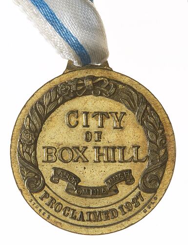
When the shire was divided on 26 May 1925 Box Hill was formed: a compact municipality bordered by Warrigal Road, Koonung Koonung Creek, Middleborough Road and Highbury Road. It contained Box Hill North parts of Surrey Hills and Mont Albert, Box Hill South, Burwood, Bennetswood and Burwood's original village of Ballyshannassy.
In 1933, in its eightieth year, the Whitehorse Hotel was demolished. Two years later Box Hill's impressive municipal offices on Whitehorse Road were opened, featuring neo-Grec forms but being enriched with Moderne ornamentation.
At the end of World War II Box Hill became suburbanized. Post-war housing expansion included a Housing Commission estate in Box Hill South. In 1954 the Melbourne and Metropolitan Board of Works designated Box Hill as one of five district centres for metropolitan Melbourne.
Box Hill city was amalgamated with Nunawading city on 15 December 1994 to form Whitehorse city, renewing the boundaries that began with the Nunawading parish and subsequent shire.
References:
Whitehorse City Council website http://www.whitehorse.vic.gov.au, accessed 20/10/2003.
Australian Places website http://arts.monash.edu/ncas/multimedia/gazetteer/list/boxhill.html, Monash University, accessed 20/10/2003.
More Information
-
Keywords
-
Localities
-
Authors
-
Article types