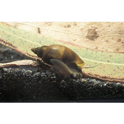
Specimen Details
-
Taxon Name
-
Preferred Common name
Freshwater Snail
-
Specimen Nature
Nature: Whole, Form: Wet, Medium: ethanol 70%
-
Collected By
B J. Smith
-
Date Visited From
20/07/1979
-
Date Visited To
20/07/1979
-
Category
-
Scientific Group
-
Discipline
-
Collecting Areas
-
Type of Item
Taxonomy
-
Phylum
-
Class
-
Subclass
-
Superfamily
-
Family
Geospatial Information
-
Country
-
State
-
Nearest Named Place
-
Precise Location
on weed, Nine Mile Creek 30km south of Kerang, Loddon Valley Highway
-
Latitude
-35.97
-
Longitude
143.95
-
Geodetic Datum
WGS84
-
Georeference Source
Collector
-
Georeference Protocol
collector
-
Georeference Date
2013-03-15T00:00:00
-
Georeference By
Dr Ursula Smith - Museums Victoria
